Desertcart purchases this item on your behalf and handles shipping, customs, and support to Cook Islands.
🧭 Navigate Like a Pro — Chart Your Course with Confidence!
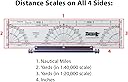
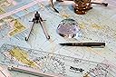
The Weems & Plath Plotter combines marine-grade aluminum roller technology with durable acrylic construction, offering precise distance scales and integrated protractors for accurate navigation on U.S. Coast and Harbor Charts. Designed for professionals and enthusiasts alike, it streamlines course plotting and bearing measurements, making it an essential tool for maritime navigation and adventurous explorers.
| ASIN | B0000AY1BQ |
| Additional Features | Aluminum roller assembly for easy course plotting and parallel line transfer, protractors for measuring courses and bearings |
| Best Sellers Rank | #115,627 in Sports & Outdoors ( See Top 100 in Sports & Outdoors ) #8 in Boat Compasses |
| Brand | WEEMS & PLATH |
| Brand Name | WEEMS & PLATH |
| Customer Reviews | 4.6 out of 5 stars 677 Reviews |
| Global Trade Identification Number | 00721002001207 |
| Included Components | Aluminum roller assembly, Semi-circular protractor, Two quarter circle protractors, Instructions on back of plastic storage sleeve |
| Item Highlight | Plot courses and parallel lines with simple direct transfer without lifting it from the chart |
| Item Weight | 5.92 ounces |
| Manufacturer | Weems & Plath |
| Manufacturer Part Number | 120 |
| Map Scale | 1:20,000; 1:40,000; 1:80,000 |
| Map scale | 1:20,000; 1:40,000; 1:80,000 |
| Model Number | 120 |
| Number of Items | 1 |
| Special Feature | Aluminum roller assembly for easy course plotting and parallel line transfer, protractors for measuring courses and bearings Special Feature Aluminum roller assembly for easy course plotting and parallel line transfer, protractors for measuring courses and bearings See more |
| UPC | 721002001207 |
C**R
A must for any sextant enthusiast
I purchased this item as a navigational astronomy enthusiast, as a complement to my C.Plath sextant and Nautical Almanac. Sextants are bulky already, and stargazing or sight reduction holding both a sextant and my astronomy charts or books while trying to write annotations becomes a messy business. These charts really complement the Nautical Almanac nicely and condense what you need for sight reduction by providing a sky map for the navigational stars... this helps you get your bearings at any time and place. Discs are provided for different latitudes, both Northg and South (a plus given typical star finders are usually provided for a general mid latitude). By entering the Nautical Almanac for a specific UT and assuming a DR position (if you got this far you probably know what I'm talking about), you can spin the discs to the LHA and you'll get a representation of what the sky above you looks like. Additionally, a separate disc is provided to make reverse calculations, so as to determine the name of a star based on its Az and height (the disc will give you the star's dec and hour angle/RA, with which you can go back to the Nautical Almanac and quickly find the star's name). This is a great tool and a must to keep together with my sextant for any sky observations.
V**Y
WORKS GREAT FOR SEA KAYAKING
I use this for sea kayak navigation, and it is excellent! I was alone, in unknown waters, in Casco Bay, Maine for 5 days. With this, a compass, and a chart, I was able to reach every destination I aimed for. It works great. The plastic is somewhat flexible. So it easily conforms to the curved deck of my kayak. It has 3 moving plastic parts. Part 1: Baseplate and True North compass rose. It is rounded on top, and flat on the bottom. The red grid lines are on this part. There is also a true north compass rose on this part. The true bearings are in a smaller font, and they are in the smaller compass rose. The vertical grid lines point to true north and true south. The horizontal grid lines point to true east and true west. At the bottom of this part there is a "ruler" to measure. It has scales for 1:40,000 and 1:80,000. FYI, I don't use that. I use this approximation: Scale 1:10,000 Your thumb to index finger = 1 mile Scale 1:20,000 Your thumb to index finger = 2 miles Scale 1:30,000 Your thumb to index finger = 3 miles Scale 1:40,000 Your thumb to index finger = 4 miles Scale 1:50,000 Your thumb to index finger = 5 miles and so on. But the scale would definitely be more accurate. Part 2: Magnetic North Compass Rose. This part has the magnetic compass rose. This magnetic compass rose is in a bigger font, and it is further out. The magnetic bearings are at the outer edge of the device. That makes it easier to read the magnetic bearings, than to read the true bearings. That helps you avoid mistakes. It is round. It does not have any grid lines. It rotates with respect to the baseplate. So you can set any declination angle or variance. There is a line for each degree. Part 3: Arrow. This is a thin strip of plastic with an arrow. It rotates to any setting. So you point it from your current location to your destination. The tip of the arrow crosses the magnetic bearing. If you want the true bearing, you can look at the smaller-font bearings, which are on the inner bearing circle. There is a line for each degree. MY CUSTOMIZATION: Let's say that you put the center on your current location. Then you look at your destination, and it is beyond the reach of the device and its arrow. That's a bit of a problem. So I added a string. There is a little hole in the middle. You can mark your position on the chart, or map, through that hole. I put a string in that hole. The end of the string at the bottom side of the device needed a small knot, so it wouldn't be a bulgy thing between the device and the chart. So I flared out the threads of the line. Then I burned it. That worked great. The burned end is wider than the hole. So it stays in place. At the top end of the string, I put a knot. I made the string as long as the diagonal dimension of a chart, so it can reach any point on the chart. If the burned end ever comes out, I can untie the knotted end, put it back, and tie the knot again. I keep the device, and the string, in it's original plastic bag. I keep them under the chart, under the bungee cords, on the deck of my kayak. It's always there when I need it. There were other similar devices that were cheaper. But they did not give you true and magnetic bearings. With this device, you don't have to add or subtract in your head. It tells you the true and magnetic bearings. The grid lines make it easy to align with longitude or lattitude lines. This device is well worth the price!
K**I
Best nautical navigation studying pack
High equality and excellent nautical navigation studying pack
P**C
Reflections annoying
Ahhhrgh. Nicely made, feels sturdy, doesn't wobble or exhibit any low tolerance behavior, but...the surface is super shiny and reflections can limit the angle you can use ruler. The black variety, which I have as well, doesn't have the reflection, but you can't see through it. What's more important? For me, almost three stars because I have to situate the work just right to not be blinded by the reflections. Maybe if you're working with maps there's a reason to see through the ruler, but for plan work and drawings, a black ruler is easier on the eyes. Maybe a slightly scuffed or satin surface texture would lessen the reflection problem.
C**Y
Works perfectly
I've used these for years, simplifies time/distance calculation
J**B
Excellent navigation plotting kit!!
The tools are high-quality, well built, and durable. A little pricey, but given overall quality I'm expecting these to last a long time and I'll get quite a bit of use out of them!! Highly recommend!
C**E
Most (not all) of what you need to navigate coastal waters
This is a great set of instruments to navigate coastal waters by plotting courses and estimating speeds, times and distances. In addition to these tools, however, you need up-to-date paper charts, a compass on your boat and a hand-held bearing compass (Plasmo makes a good, affordable one) for taking fixes and establishing lines of position. Combine all that with a simple GPS system and some dead reckoning. Then you're all set to figure out how far, how much time and what route to get there without running aground.
M**.
Nice
Not used it yet
S**G
After lengthy delay delivered.
Product finally arrived and is as described. Seller responded in a timely fashion to quesitons and was helpful in locating the package. The product is in original packaging with instructions. Recommend seller.
F**S
Smoothing Sailing
Excellent product, well packaged and shipped quickly
A**I
Ottimo regolo nautico
Consente immediatamente calcoli necessari alla navigazione.
H**T
Rechenschieber für die Weg-/Zeit-Berechnung
Die Rechenscheibe erfüllt ihren Zweck ohne Probleme. Ob ich sie wirklich brauche? So schwer ist der Dreisatz ja eigentlich nicht. Wer aber nicht gerne rechnet, kann dies mit der Scheibe einfacher erledigen.
D**N
Excellent
Calculs rapidement fait sans être dépendant d'une pile ou batterie.
Trustpilot
1 day ago
1 month ago